State Highway 2 - Corbaley Canyon & Pine Canyon

Despite being internationally known as “Pine Canyon”, the bottom half of State Highway 2 is actually “Corbaley Canyon” between Orondo and Waterville in Washington State.

Pine Canyon starts about 3 miles up Corbaley Canyon at Graffiti Point.

Washington State

Here is the official history:

Waterville, the county seat of Douglas County and centrally located in Washington State, sits on the high plateau of the Big Bend of the Columbia River above the “breaks,” a jumble of rugged canyons leading down to the east side of the river.

At 2,650 feet, Waterville is the highest elevation incorporated town in Washington State.

Getting to Waterville was difficult when the first settlers arrived. They had to use trails down the sand and dirt creek-beds to Orondo.

Later on, when the pioneers started producing grain, it became obvious transportation to market was a huge obstacle.

Waterville’s position high on the plateau above the Columbia River made access to nearby river ports nearly impossible for heavily-loaded wagons.

Douglas County

Waterville’s geographic location created many obstacles to overcome when building roads to the Columbia River, 9 miles away.

Watch the introductory video below for a brief overview of Corbaley and Pine Canyons, see amazing photos and listen to #1 hit songs from 1916, 1949 and 1964.

TIMELINE OF MAJOR EVENTS

1882
Before 1882, Pioneer Settlers found it nearly impossible to get their wagons from Orondo to Waterville.They finally took an arduous stab at it and arrived in 1882… Almost ten years ahead of the government land agents

1906
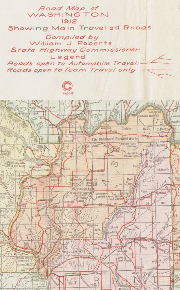
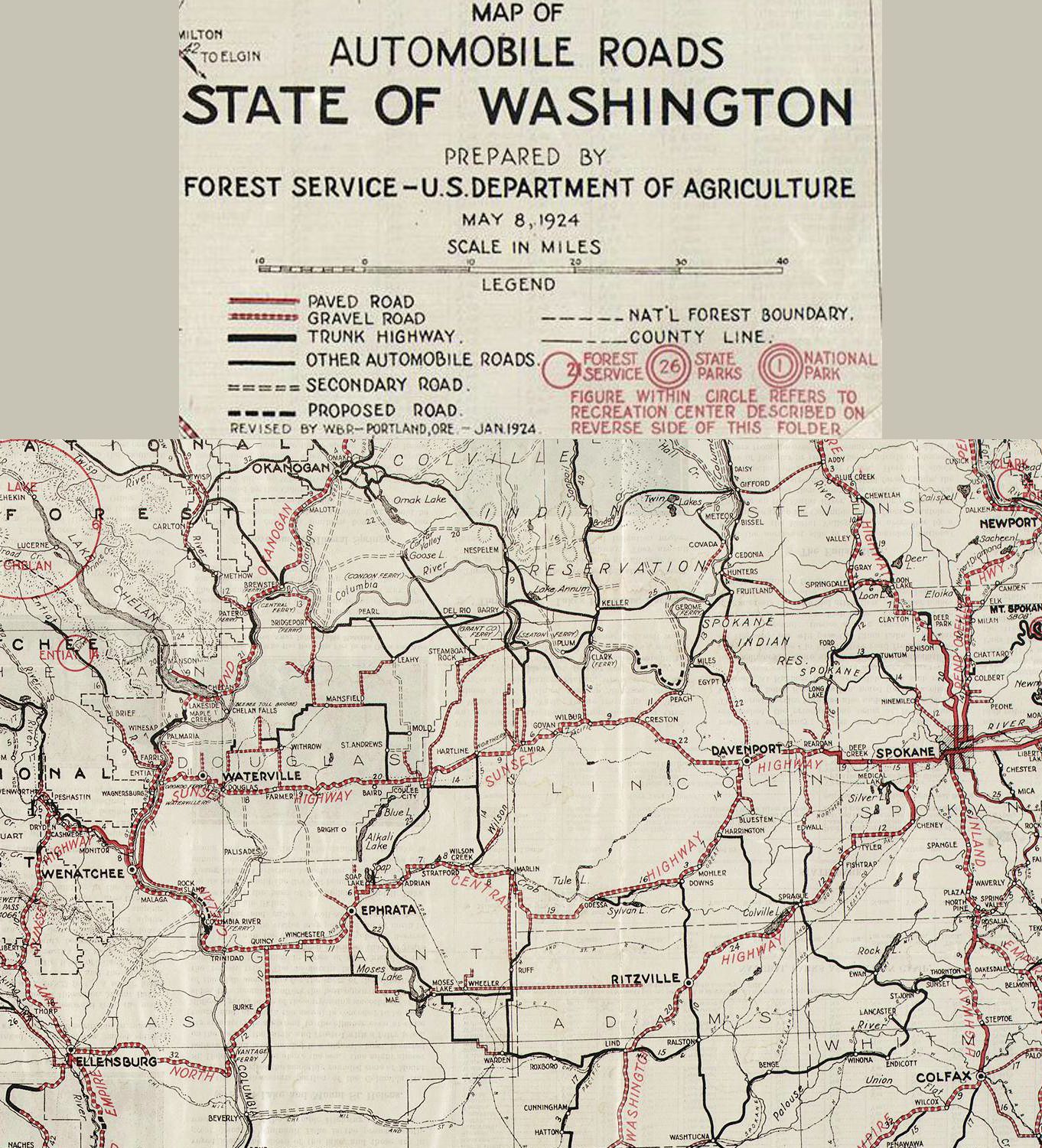
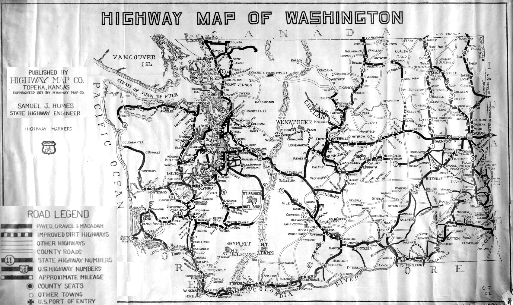
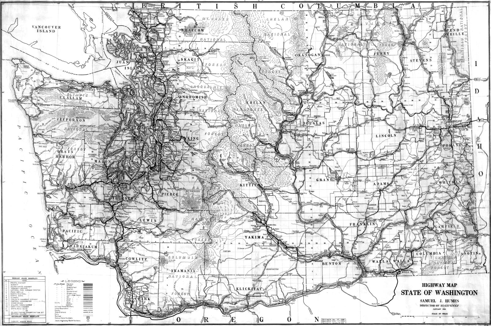
The State of Washington designed a trans-mountain route in 1906 that ran from Renton to Spokane. They called it called State Road 7.

1907
Douglas County Railroad magnate, Great Northern Railroad executive Sam Hill,
organized and ran the Washington State Good Roads Association.

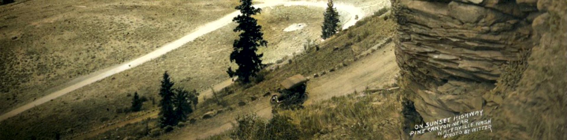
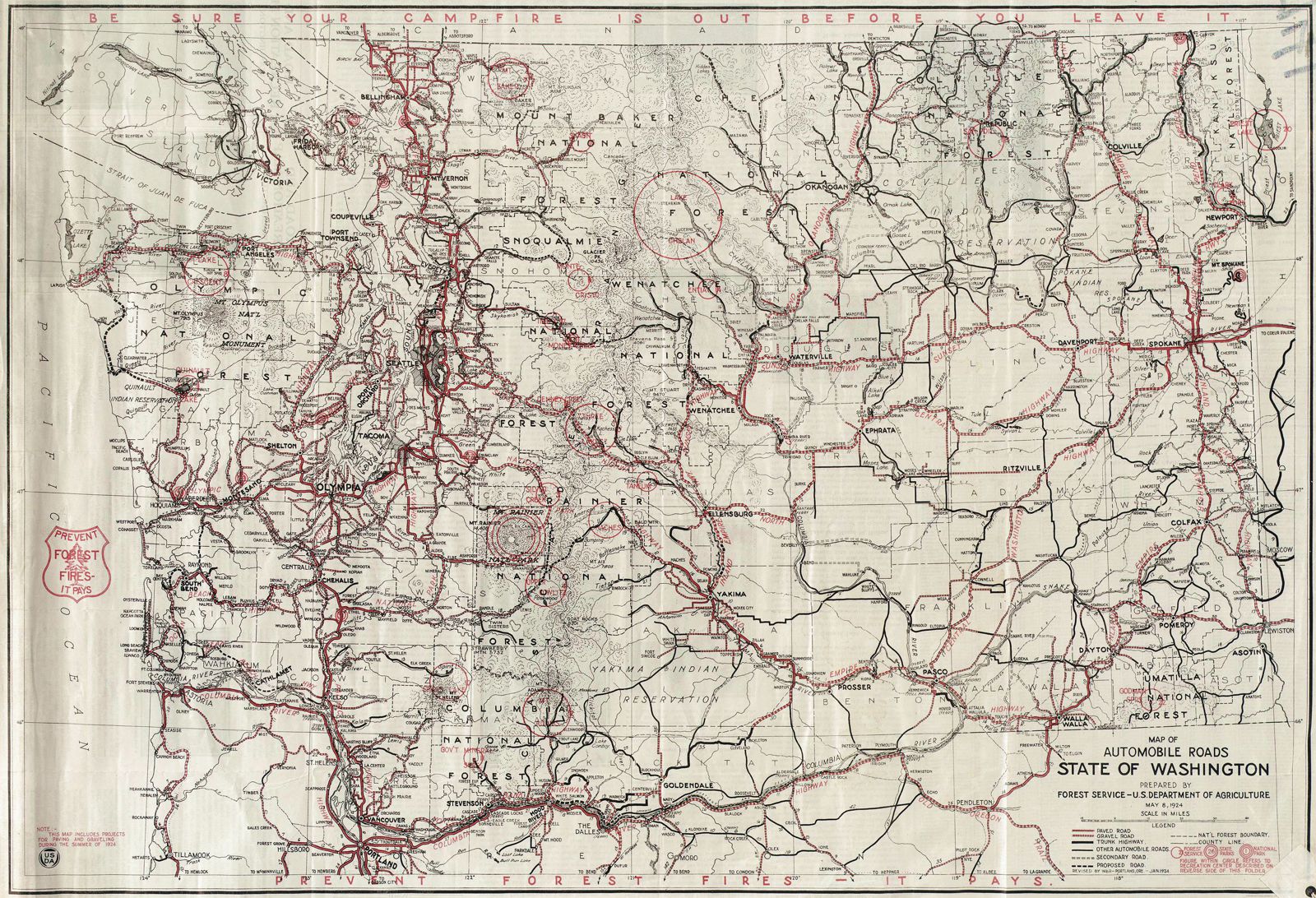
They met in 1907 at Vantage and promoted (pushed) the Washington State legislature into making The Sunset Highway a fully functioning, usable, cross-state road. Originally the state had numbered it State Road 7, but the US Highway Commission renumbered it US Highway 10. We still call it the Sunset Highway but now it is also known as US Highway 2.

1909
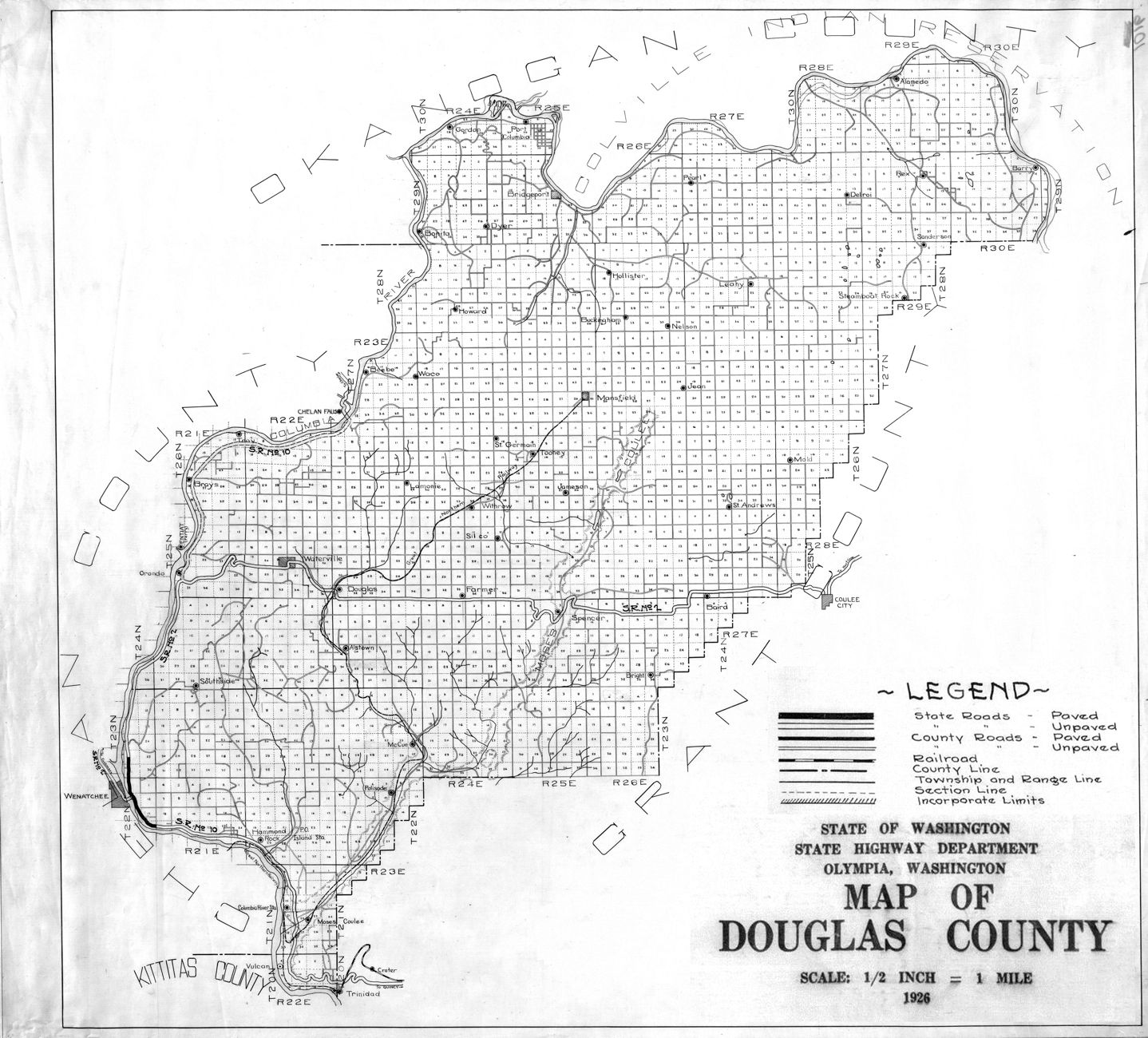
When the railroad finally decided to venture to Douglas County in 1909, they bypassed Waterville because of the cost.

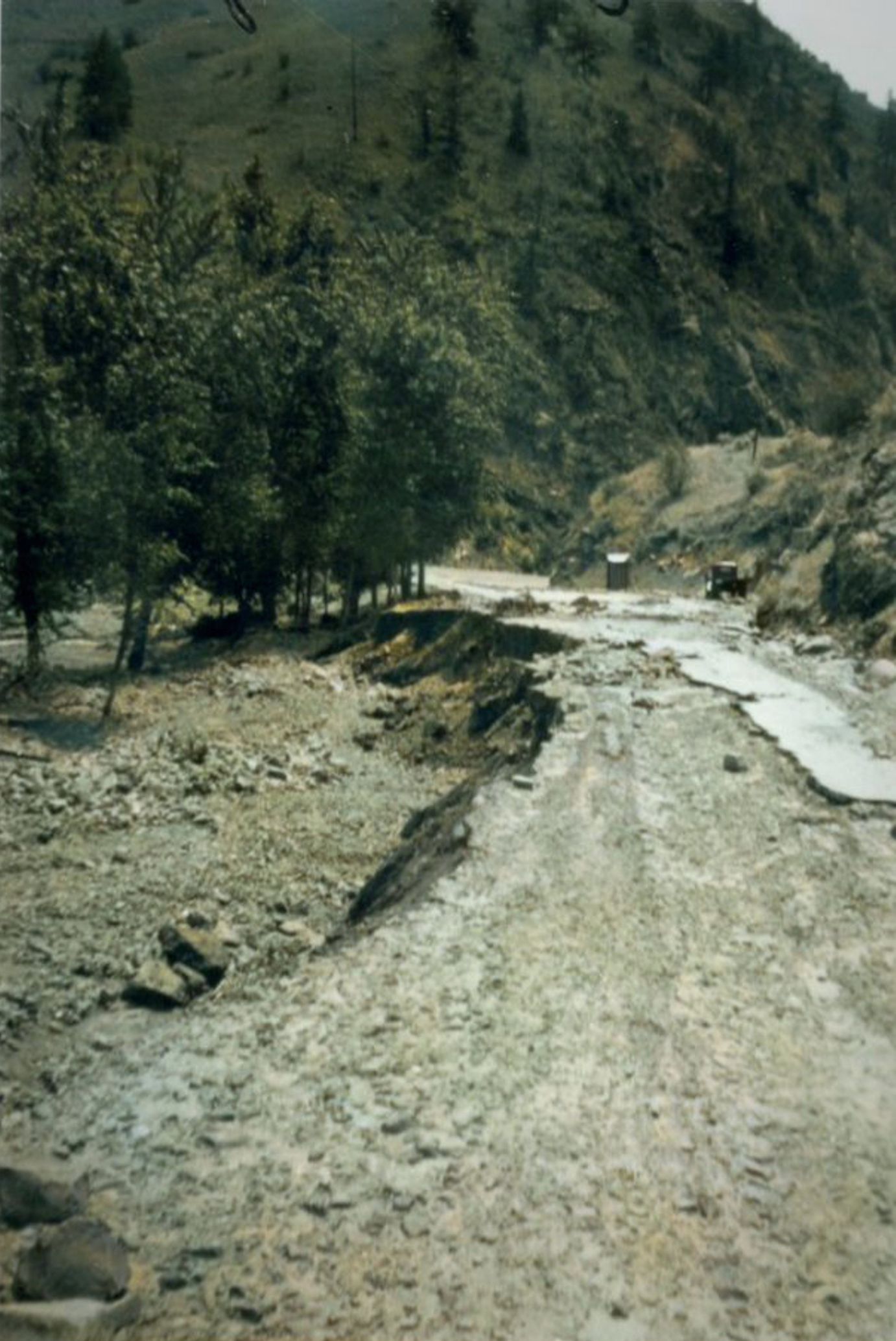
So, the people of Waterville raised the money in one weekend and built its own private rail line to connect to the Great Northern Line 4.5 miles away.

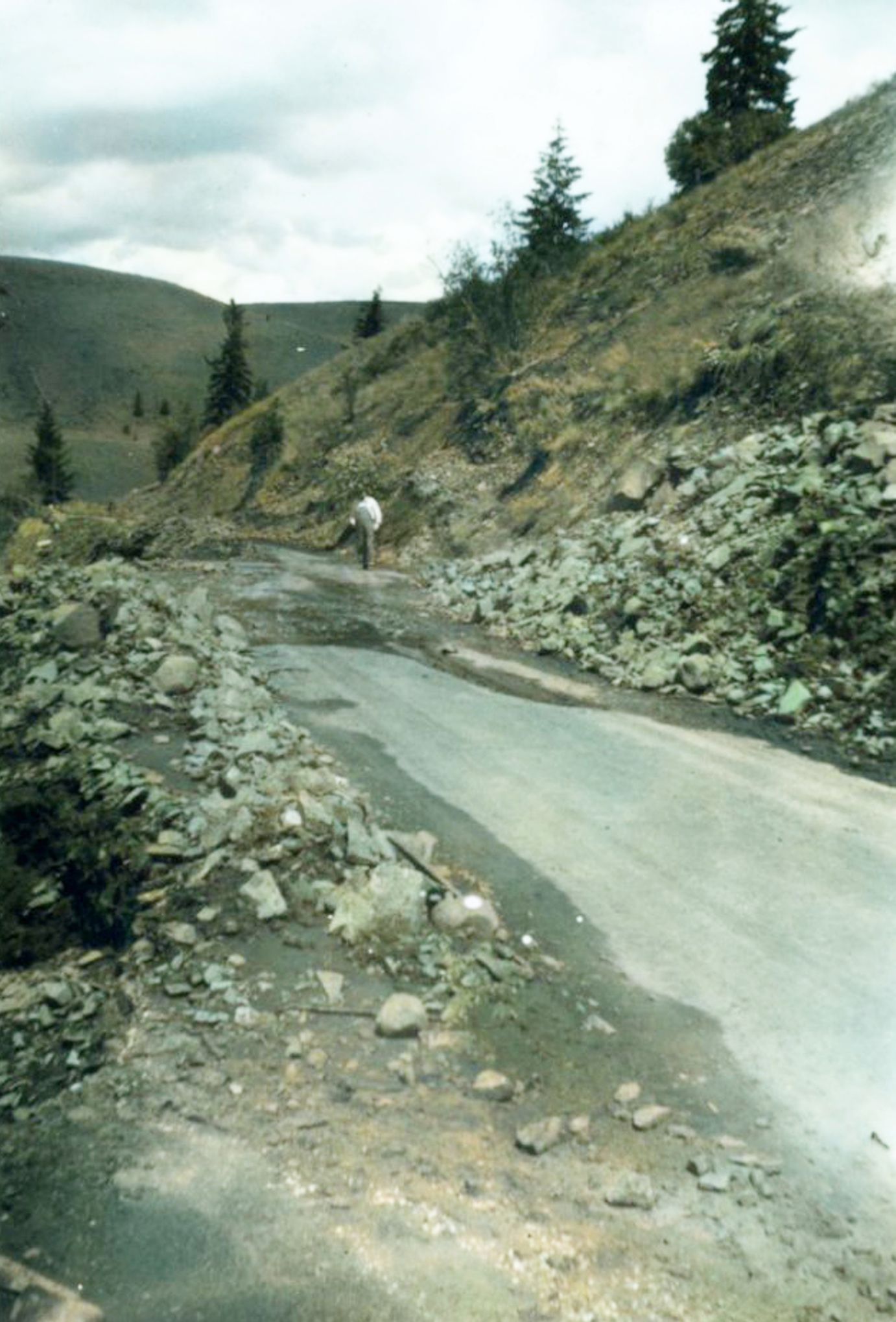
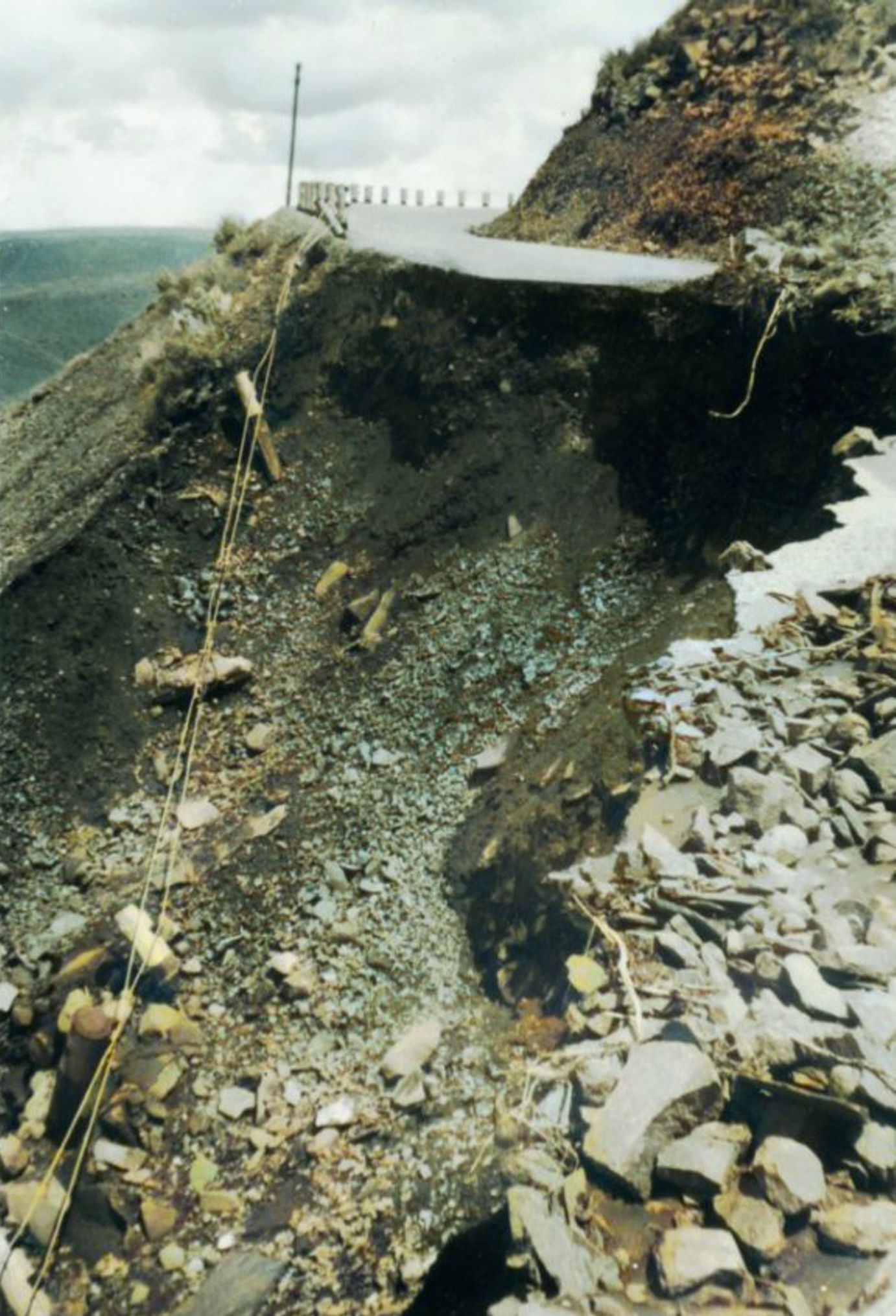
It served as the shortest privately owned railroad system in the United States until June of 1948 when a flash flood washed out the line.

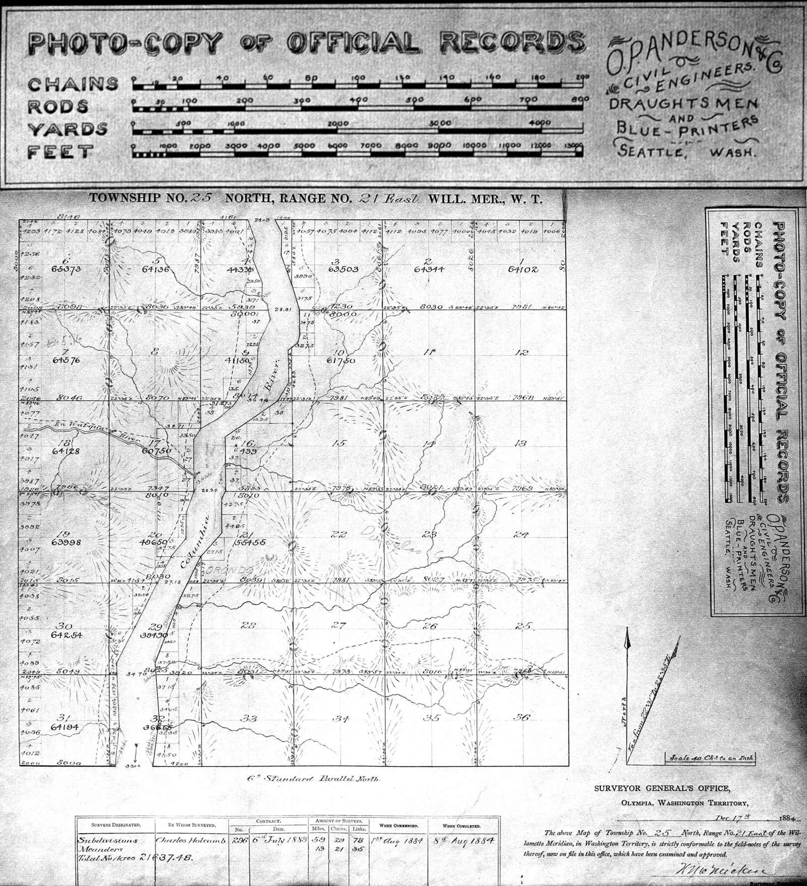
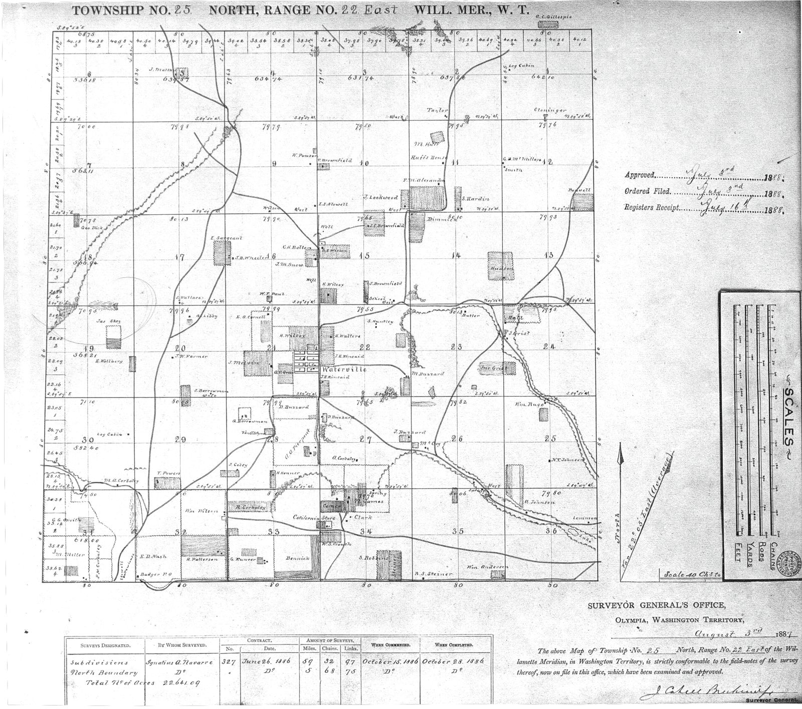
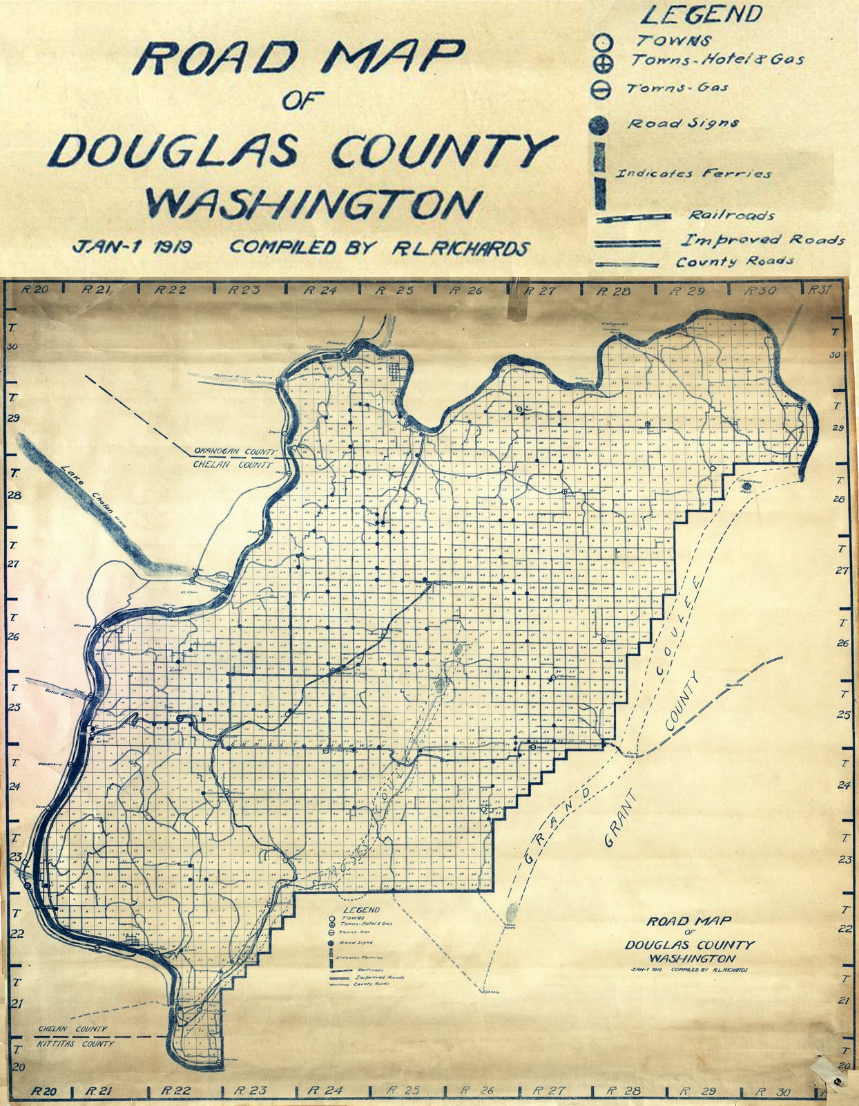
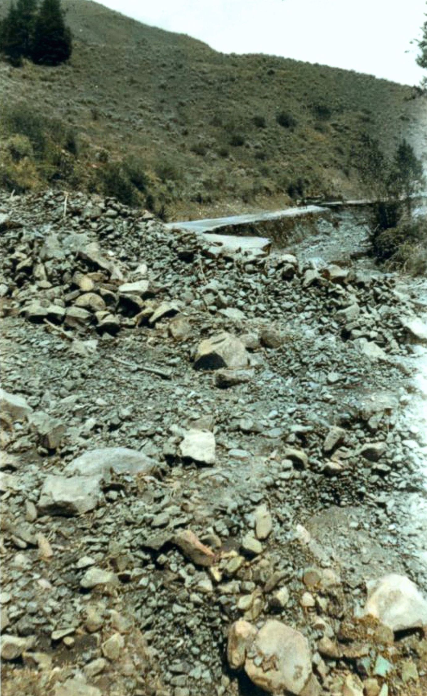
Waterville sits at nearly 3,000 feet on the largest plateau anywhere. This spot on earth is larger than Rhode Island and was empty land until the final decade of the 19th century.

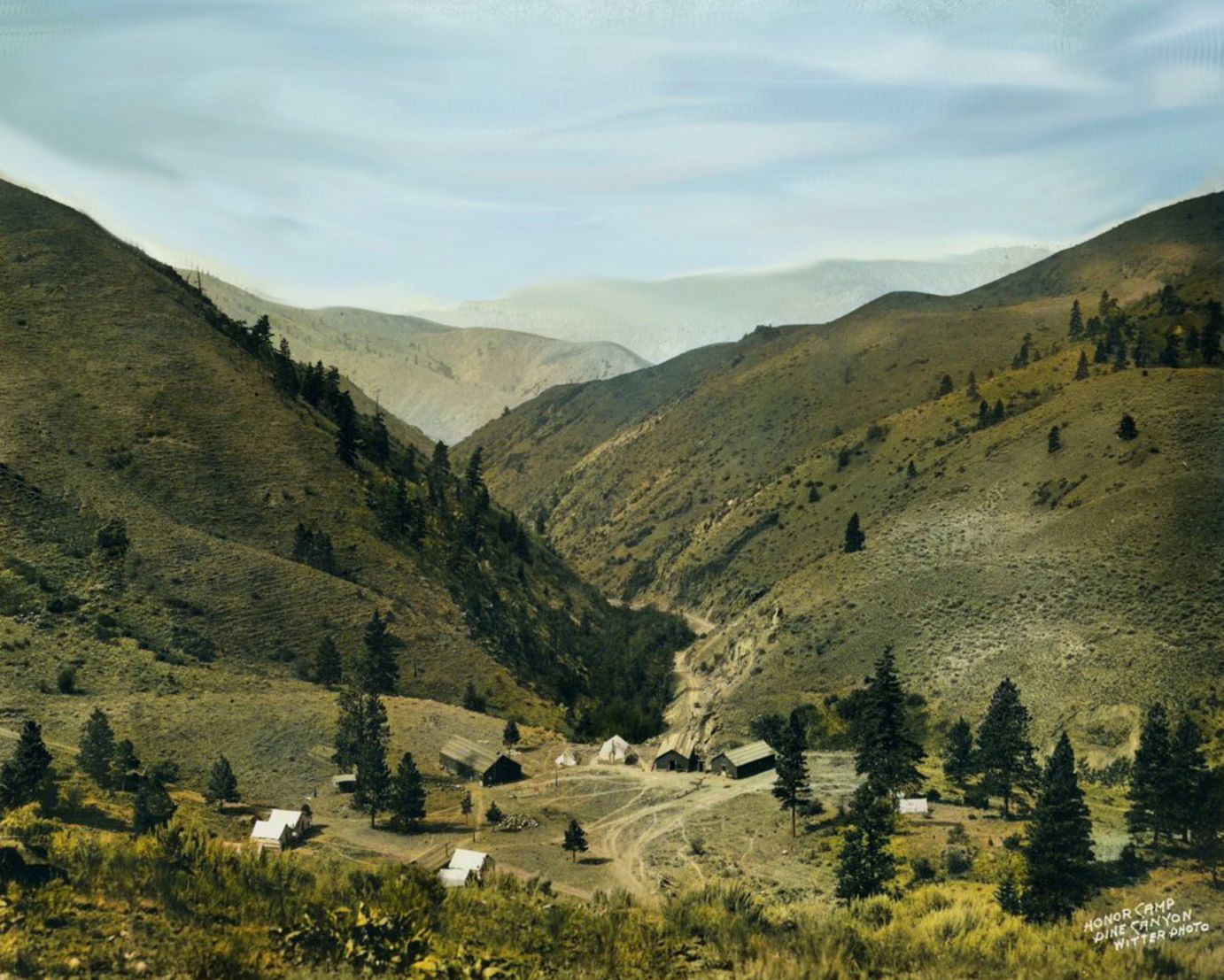
Surrounded by rugged basalt cliffs, travel proved difficult. In a time long past, getting things in and out required a Tram System down to the Columbia River. A more gutsy person might go after their own stuff by taking a steep and treacherous wagon ride on a narrow and rocky trail. Depending on their load weight, they might need 6 or 8-horse hitch.

Also in 1909
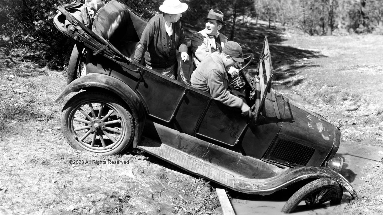
The Alaska-Yukon Pacific Exposition hosted a Transcontinental Auto Race from New York to Seattle. The cars sank into and squirmed in axle-deep mud through most of the race path. That publicity welded into the minds of the public the need to improve the wagon roads for automobile use, which led to a new state designation (see 1913 below).

1913
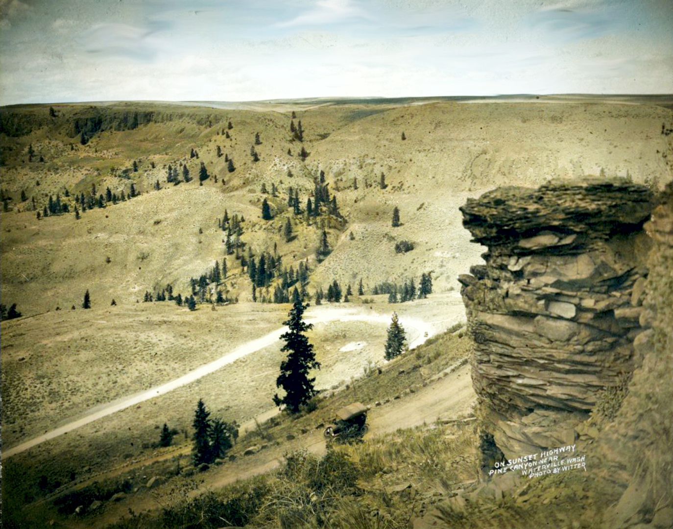
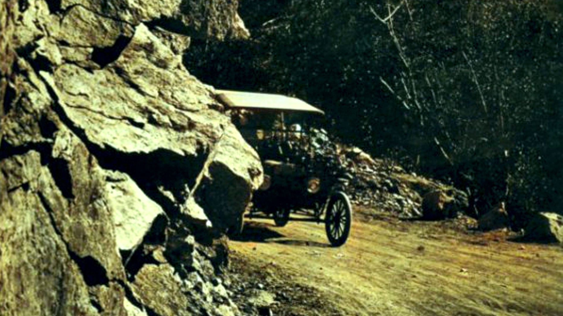
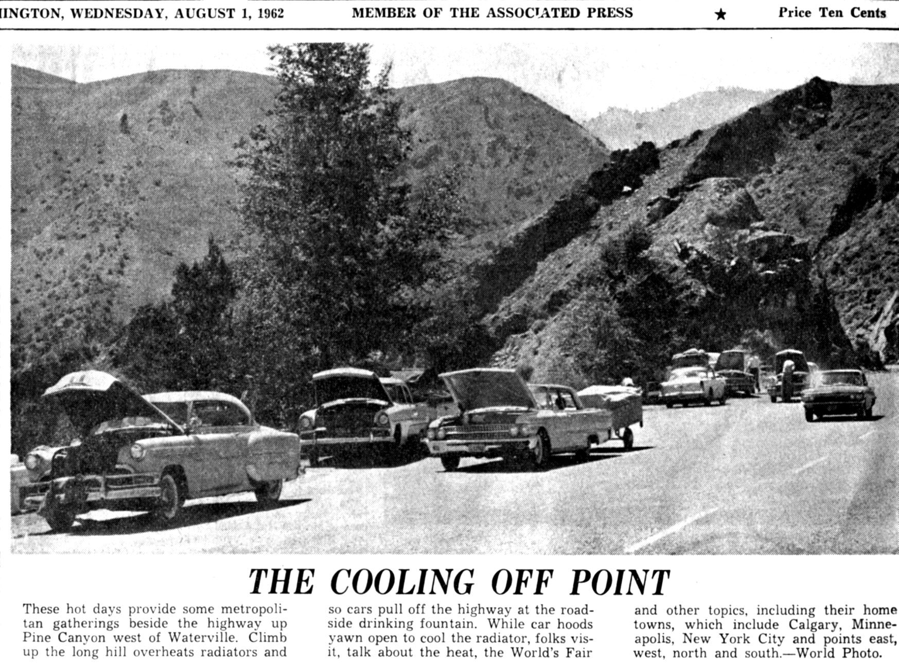
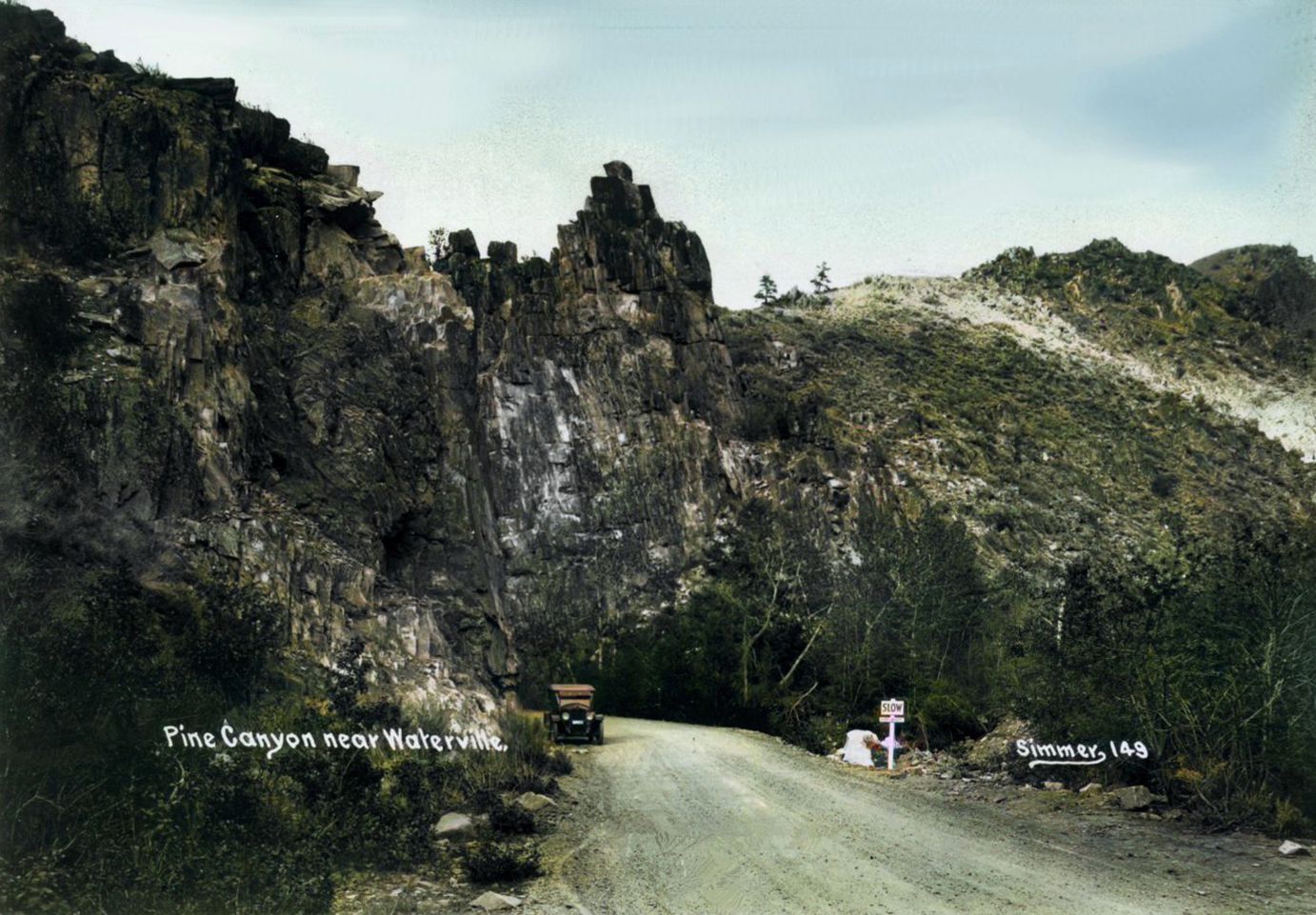
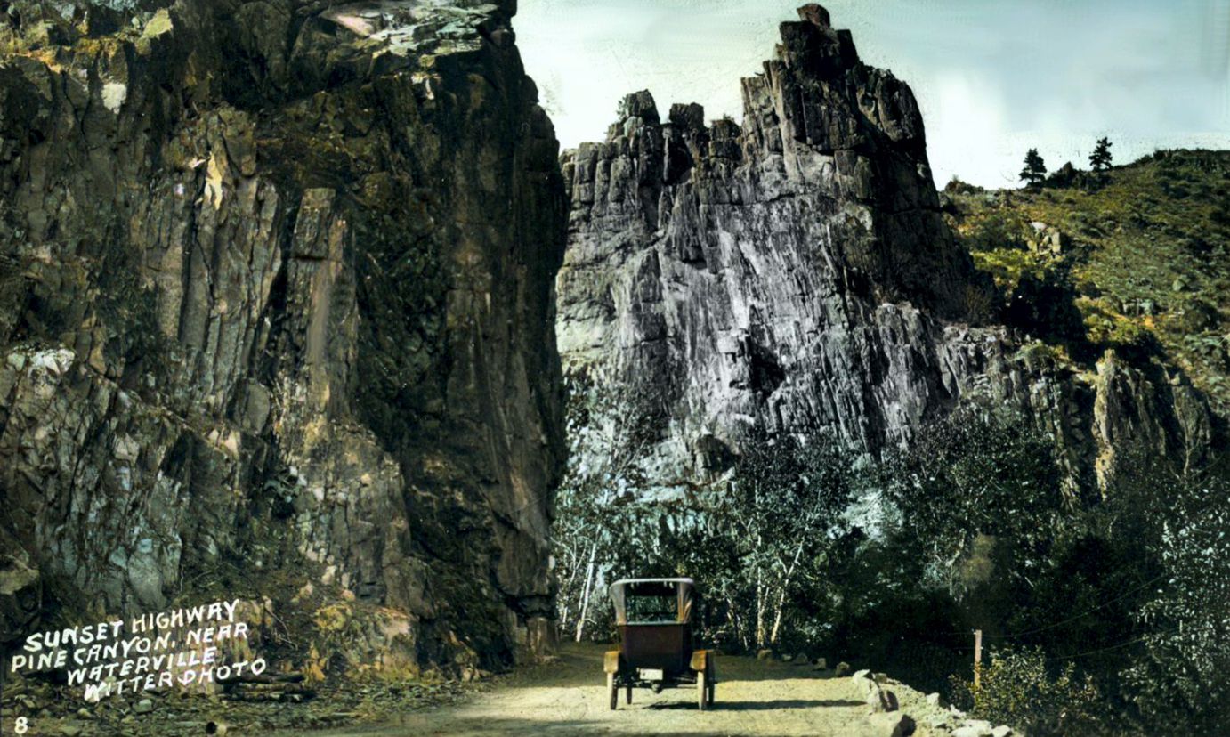
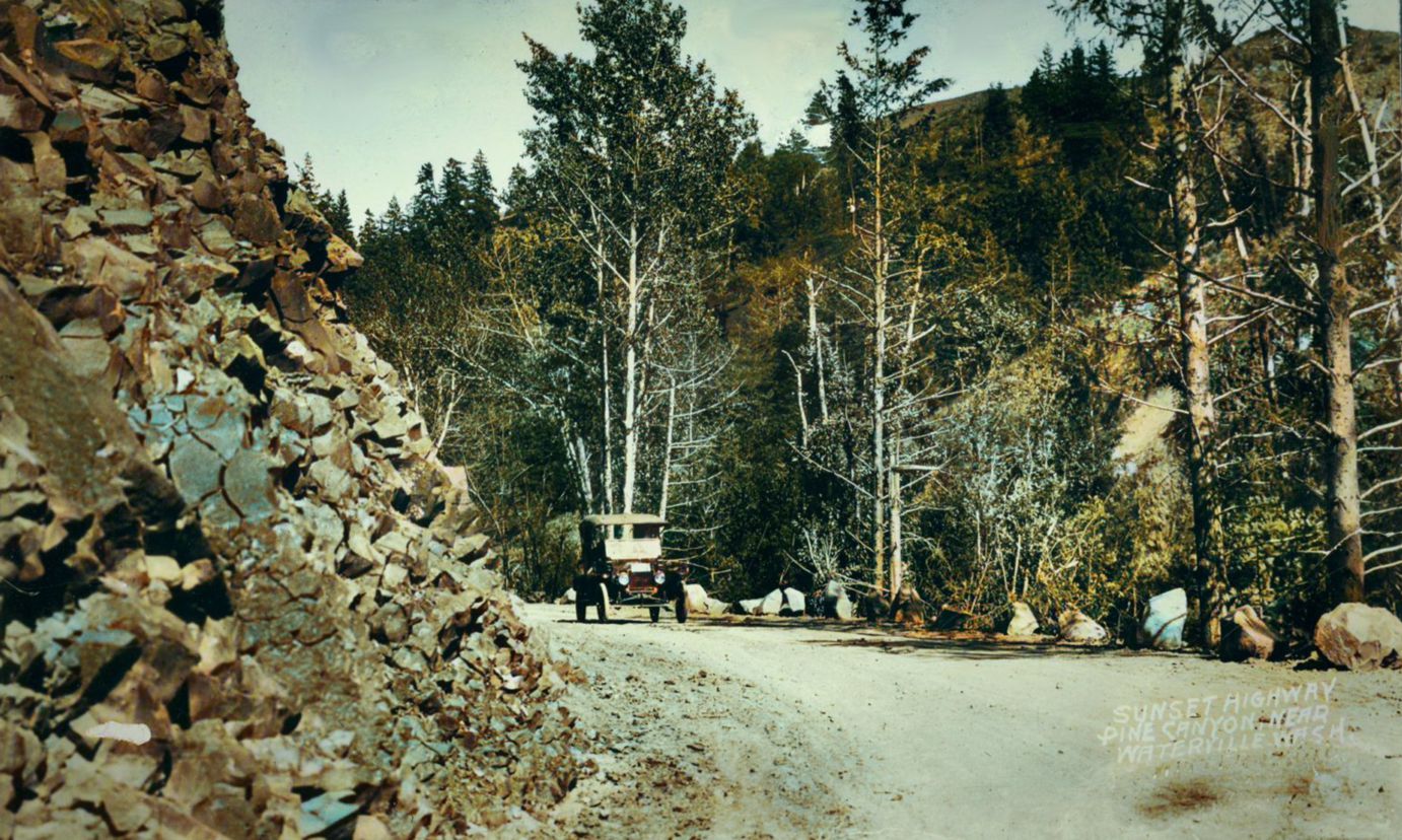
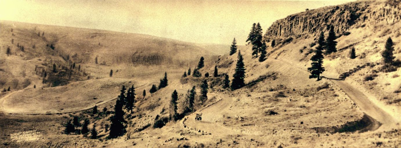
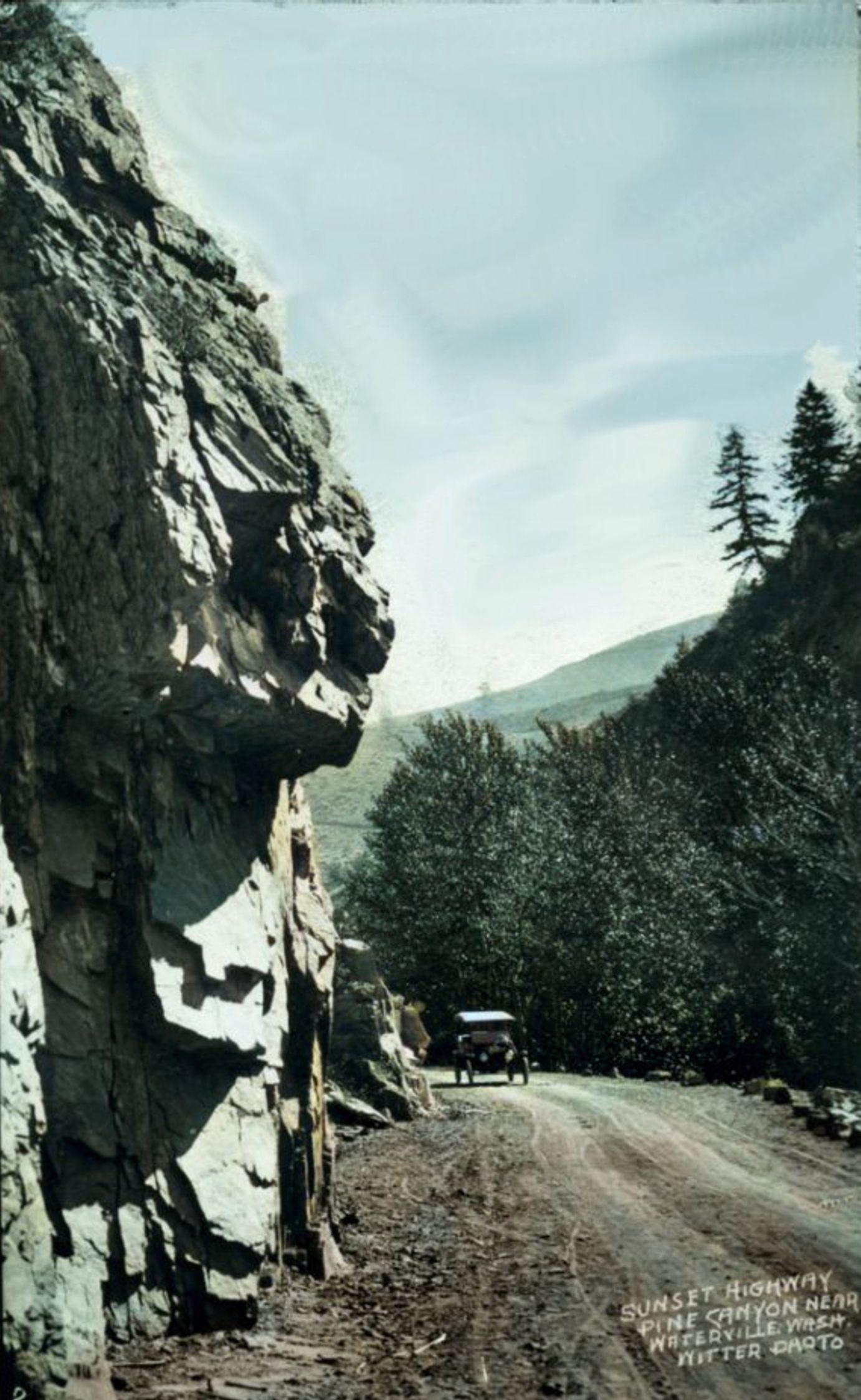
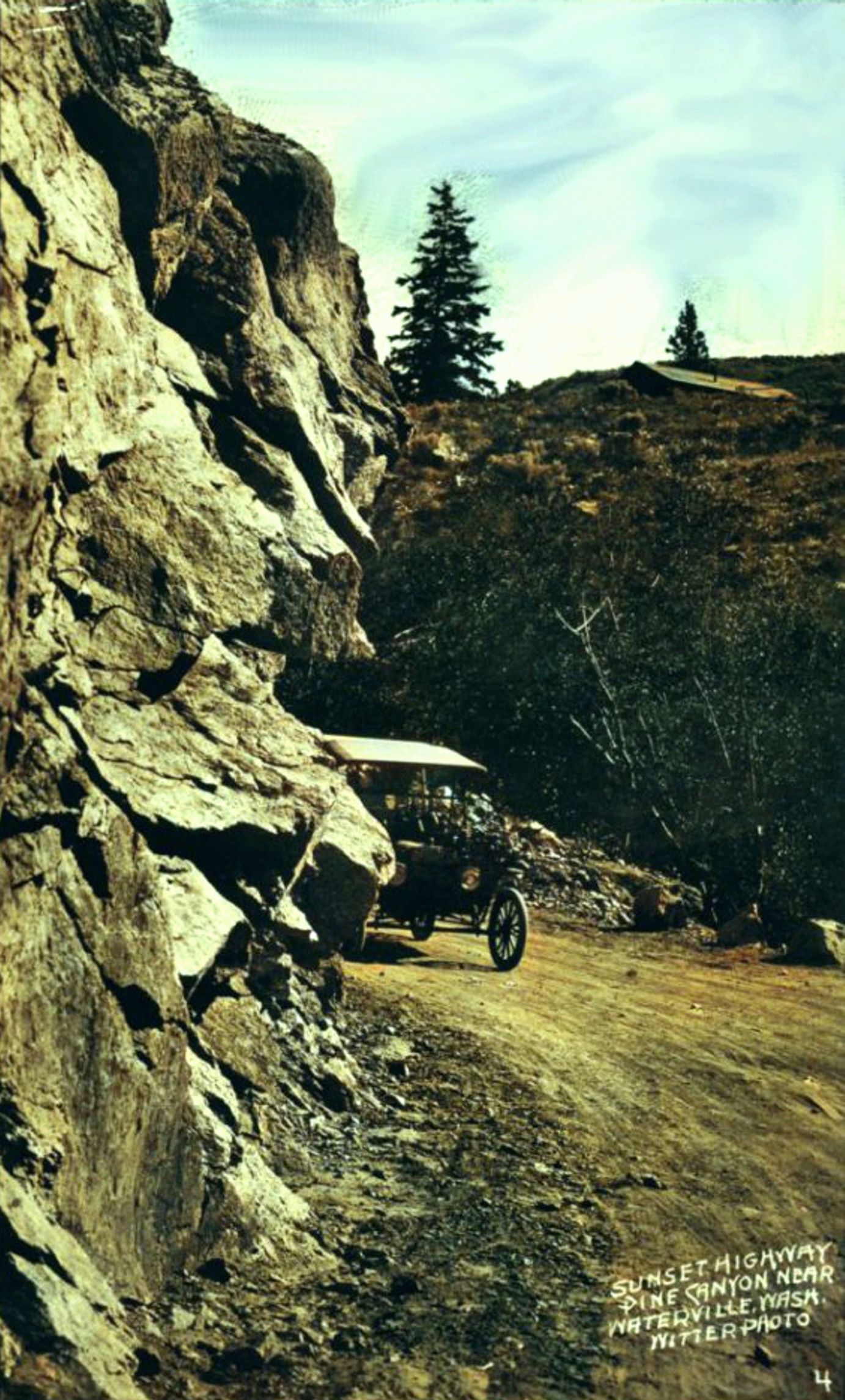
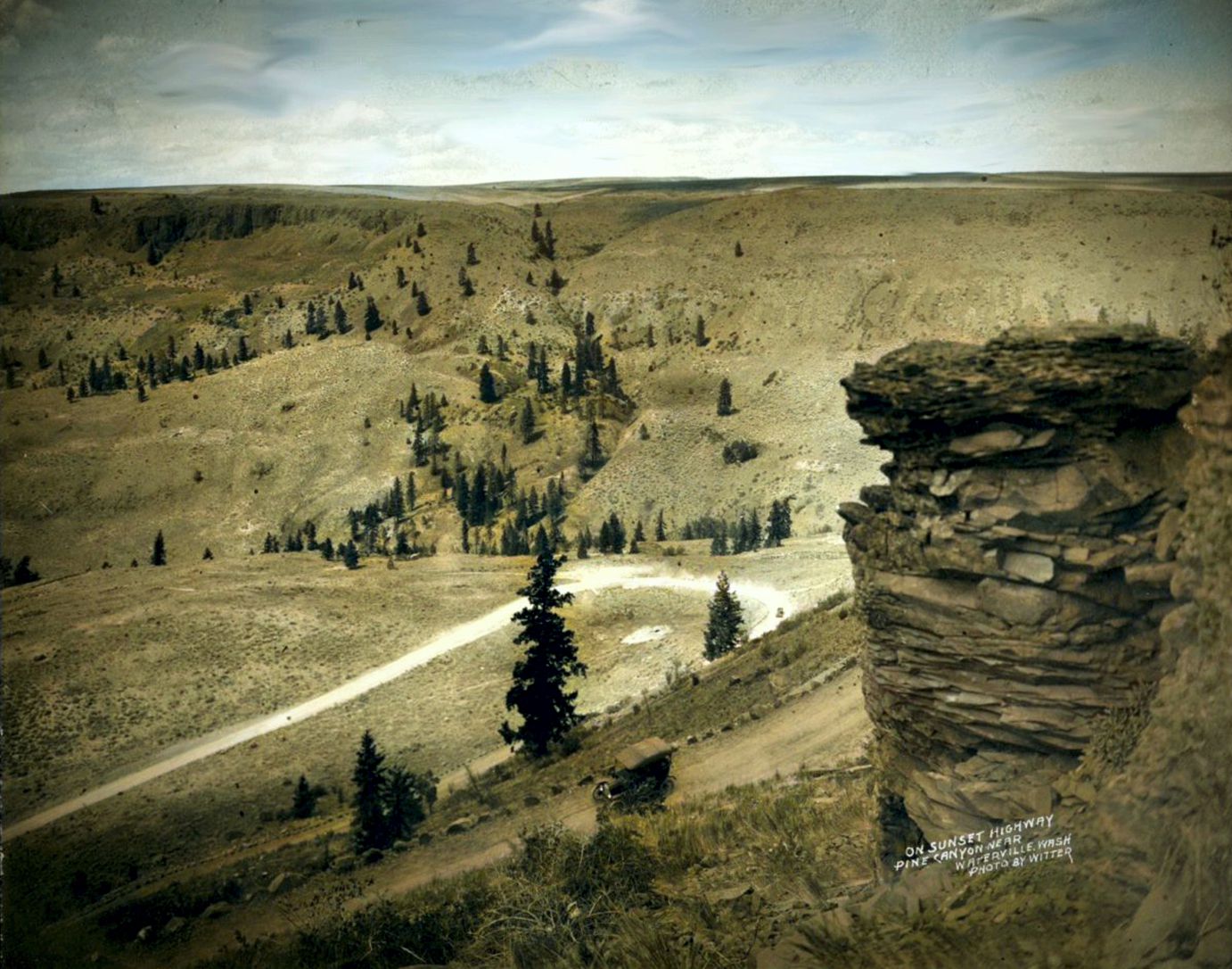
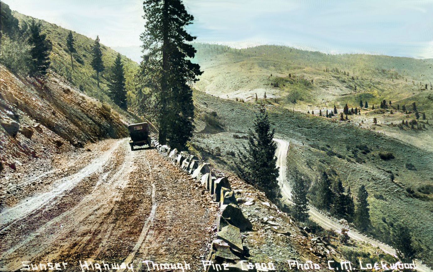
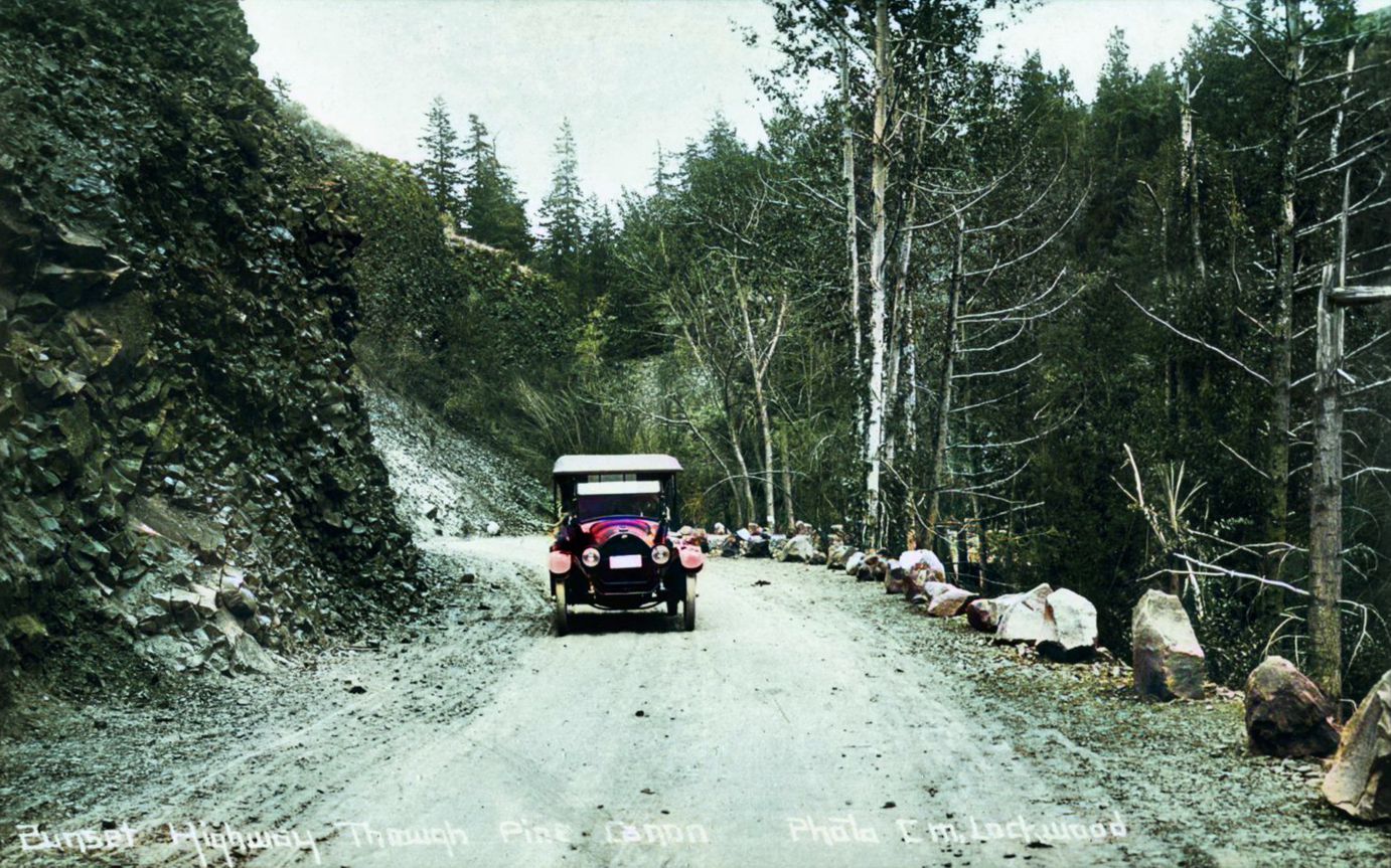
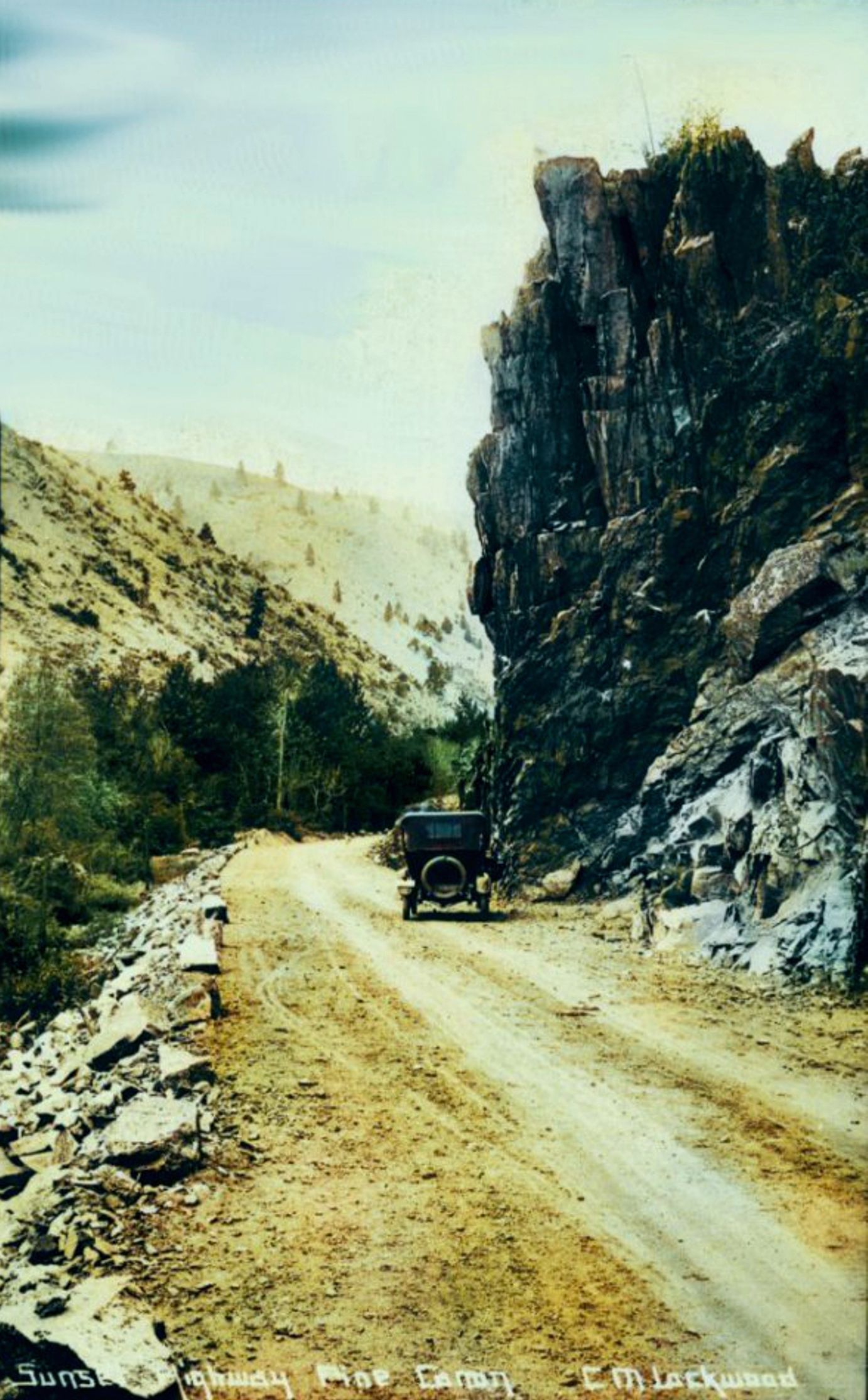
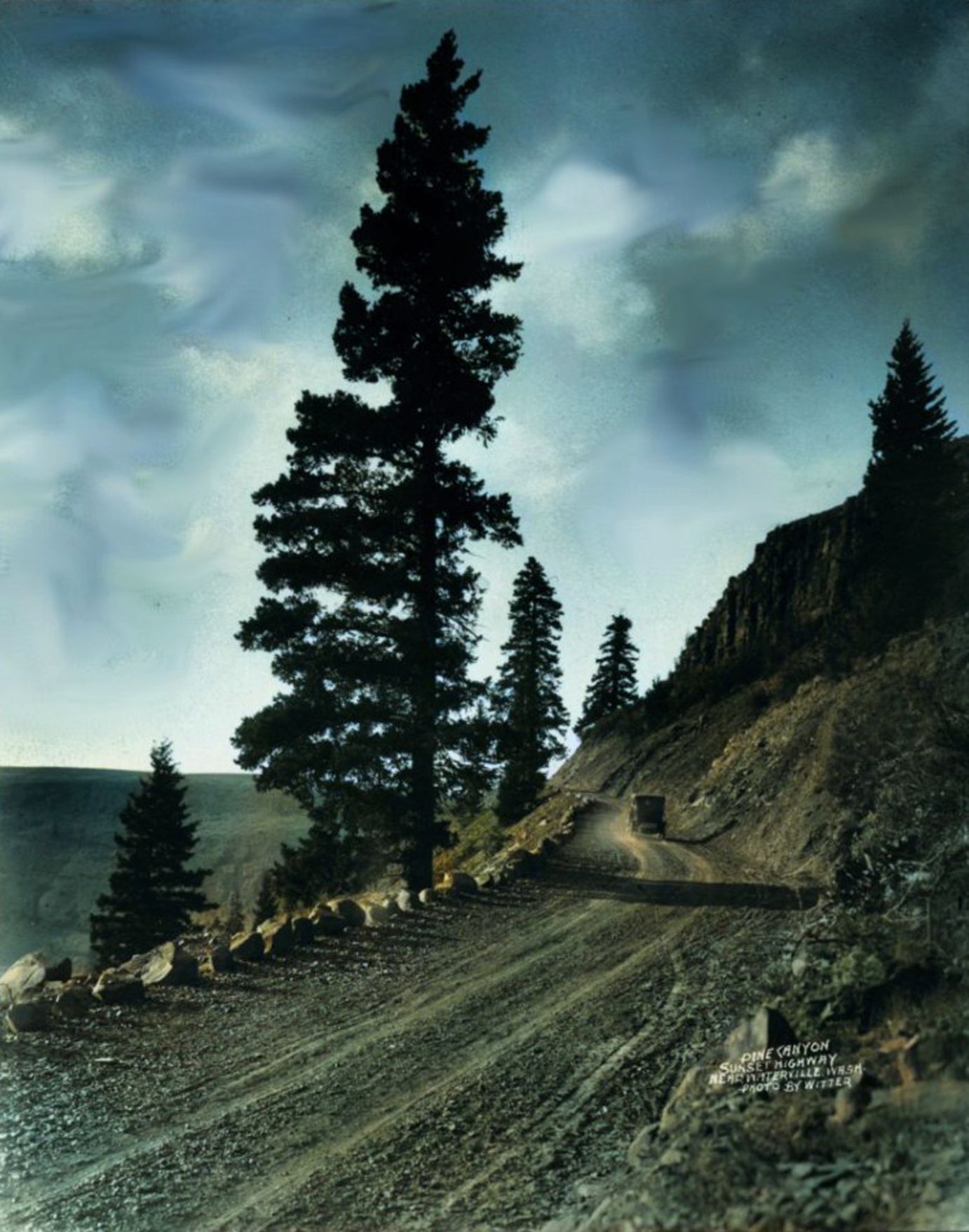
In 1913 the State of Washington designated this new road, The Trail to the Sunset, and began new improvements throughout the state including Pine and Corbaley Canyons.

1915
July 1, 1915, the Sunset Highway was officially improved and dedicated as a packed dirt road. Packed oil came later and after that a concrete roadbed (1934).

Also in 1915
The State of Washington brought in a crew of Honor Prisoners from Walla-Walla State Penitentiary to perform needed improvements through Corbaley and Pine Canyons.

They lived in a stockade built at the junction of Corbaley and Pine Canyons and worked with little supervision.

The State assigned them to hack and wack the old cliff-side road and switchbacks out of solid rock.

The road these men built curved south from a westward path out of Waterville.

With sledgehammers, bars, and shovels they curved their way around the cliffs in a descent to the Pine Canyon creek bed near the junction of County Road 2.

They then shoveled out a good roadbed onward to Orondo.

Honor Prisoners received 50¢ an hour held in their name by the State until they completed their task of chiseling the road out of rock.

1916
The State of Washington did answer the call for road improvement made by the Good Roads Commission (1915).

On May 16, 1916, the Governor dedicated the rock-hard work of the Honor Prisoners.

With the Honor Prisoners present, and the Good Roads Commission well represented, the Governor proclaimed May 16, 1916 “Good Roads Day.” 

June of 1916
60 out of a little more than 100 Honor Prisoners received a farewell dinner and the commutation of their sentence becoming free men in exchange for their year of hard work.

1925
May 14, 1925, the Big Bend Empire Press in Waterville energized the public with the news that the Executive Committee of the Yellowstone Trail Association investigated the Sunset Highway and decided to make it part of the Yellowstone Trail.

The traffic count on the Yellowstone Trail at Spokane indicated two-thirds of the tourists traveling to and from Yellowstone followed the trail south through Lewiston, Walla-Walla, and Yakima.

Changing the route to follow the more direct route on the Sunset Highway represented the most significant advancement in the Yellowstone Trail system.

1934
The State of Washington completed paving the Sunset Highway with concrete in 1934. This project came to a close nine years after the Yellowstone Trail Association began pushing for the Sunset Highway to be paved.

1947-1948
With the newly improved Pine Canyon Sunset Highway, a person could now drive to Wenatchee, cross the river on the 1909 Columbia River Bridge, do some shopping, and return the same day.

With improvements like a packed oil surface, then cement, the Sunset Highway remained in use until 1948.

May and June of that year devastated the Highway.

The Winter of 1947-48 produced a higher-than-average snow-pack followed by a wet spring and fast-rising temperatures after May 15. Parts of the Sunset Highway in Pine Canyon washed out in a flash flood on May 20th.

The state reconstructed the road with temporary repairs and it reopened on June 10th… Just in time for the cloudburst that washed out Pine Canyon that evening.

Cars on the newly reopened road were stranded on high ground.

Ben Furman used a Bulldozer in an attempt to divert the torrential flow, but the outhouses, Fruit and Ice cream stand, campground, and spring built up at Beaver Den Springs washed away with many of the trees.

And the Pine Canyon portion of the original Yellowstone Highway closed permanently.

The State of Washington abandoned the original road in Corbaley Canyon and opted for building the current cliff-side roadbed from Orondo to County Road 2.

They connected the upper road hacked out by the Honor Prisoners to the new road at County Road 2.


June 17, 1948
Waterville Empire Press front-page article on flood.

1965

The Honor Prisoner upper end of Pine Canyon Road continued in use for 50 years.

In 1965 the Washington Highway Commission designed and built the current Highway 2 connection to Waterville.

That horseshoe, with a new connection at the edge of Waterville, was dedicated on August 4th.

Following the closure of the old, curvy, and steep Honor Prisoner Road, Sports car races were held for several years until a fatal crash brought an end to this sporting event.

Spurred on by the car races, local boys competed in drag races on that strip of the road until the State Highway Commission built earthen and rock berms to block automobile traffic.

The old road is now caved in and closed to everything except the daring hiker.

The fresh-water springs on the old wagon road were important to the teamsters as watering holes for their horses.

But cars also suffered from thirst while climbing up to the Plateau.

This problem persisted into the 1960s.

On the new elevated highway, the state built a new drinking fountain and named it after the long-term Highway worker Fred Carpenter.

They also added pullover areas just east of the cut-through because large numbers of eastbound cars had to stop to cool down their engines and refill their radiators at that point.

Getting from here to there is less adventurous, smoother, and a lot faster than it was in 1882.

But the wonderful vistas enjoyed by slower-moving traffic and the social outlet at Beaver Den Springs are gone forever.

Now we just have the hurry and rush of getting from here to there.